3.7 KiB
3.7 KiB
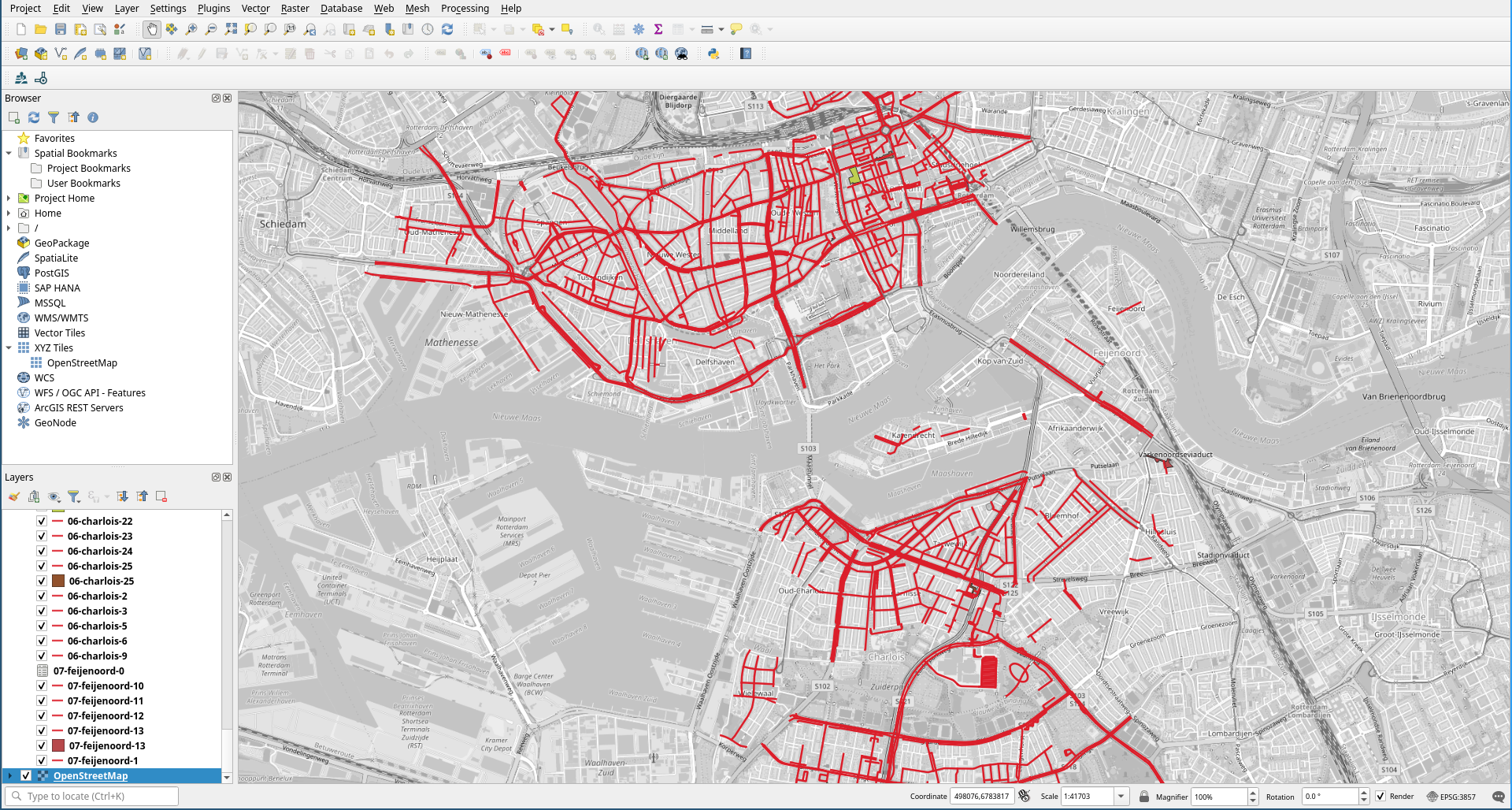
Mapping cameras in the city
Rotterdam has a lot of streets with live view cameras. The list of these streets is published in Gemeenteblad for the city and this is an attempt to put this data on a map. The specific locations of cameras aren't published but this is a good start.
here's where you can find the lists
Caution
This map is not complete! Look in
docs/add-manually.mdfor a list of streets/parks etc that were not properly imported. Also check the gemeenteblad before trusting this map as the data might have changed in the meantime.
How to view the map on your computer
- Install qgis
- in qgis, go to Plugins → Manage and install plugins → find QuickMapServices and install it
- go to Project → Open and open the
.qgzfile
Info
this is a WIP, the current structure of repo is as follows:
docs/add-manually.md- list of places that are not picked up by scripts and have to be added manually to the map. it's important to update this based on the info you get fromworking-data/05
source-dataall-streets- what I copied from the OG 2022 gemeenteblad with the camera plan. Doesn't include further changes. Not very usefulby-district/- the document that describes the camera surveillance divides the city into 11 districts. So there's 11 files in that directory, each containing an annotated list of streets in that district, with further updates from the gemeente. Also includes spelling fixes (surprising amount of misspelled streets in the source documents, but sometimes also the streets are just called differently in OSM. For example Overpass doesn't like "1° Pijnackerstraat" but "1e Pijnackerstraat" works fine. Or the municipality put A. Wellingpad in the document they published but the street is actually called Alberta Wellingpad on OSM.)query-headerandquery-footer- don't worry about it too much, this is used byscripts/03-build-query-for-districtwhich includes the header and footer in every file it generates. You'll need to play with this if you choose to run these scripts for a different city, because that's where Rotterdam is coded in.
scripts/- the heart of this repo. A set of bash scripts using some basic unix utils and the Overpass API to parse the source data and return jsons that can be converted into geojson. They should be ran in order, starting from01-sed-to-single-line, till05-show-missing-streets. Each of them will take data from the previous one and output toworking-data/its-own-numberso you can inspect the data at every step of the process.geojson-files/- QGIS, which I use to assemble the maps accepts data in geojson format. This is where those files should land. Think of it as the output directory of this program. This is not populate by any script. You have to runfor i in working-data/04/*; do osmtogeojson "$i" > "geojson-files/$(basename $i)"; donefrom the root dir of this repo to get those files, andosmtogeojsonis a node.js program that you obtain by runningnpm install osmtogeojsonworking-data- this is where each script outputs its data. Ideally you don't need to look into here, except for debugging. one interesting place isworking-data/05which contains all the places that were requested from the overpass api but didn't return for one reason or another.